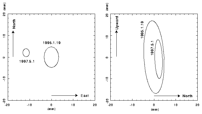
Figure 1. Comparison of KASHIM11 position estimated from two joint experiments. The ellipses express one sigma uncertainties of the estimated position (a) in the horizontal plane and (b) in the vertical plane.
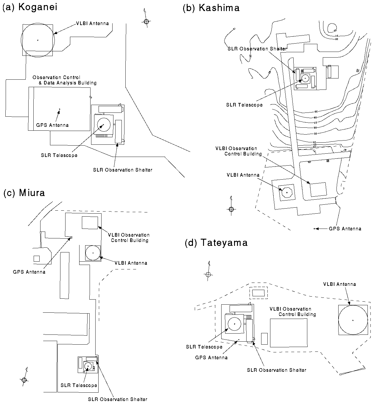
1 Kashima Space Research Center
Communications Research Laboratory
893-1 Hirai, Kashima, Ibaraki 314-0012, Japan
2Communications Research Laboratory
4-2-1 Nukui-kita, Koganei, Tokyo 184-8795, Japan
Uncertainties in the results from the first experiment are larger than the results from the second experiment mainly because KASHIM34-KASHIM11 baseline data were not correlated in the first experiment. From the comparison, vertical position and North-South component of the KASHIM11 station is consistent between the two experiments, while there is a significant discrepancy in the East-West component. The cause of this discrepancy is not known but it might have been introduced when the vertical alignment of the pedestal of the antenna at Kashima was corrected in February 1996. The movement of the intersection of the Azimuth and Elevation axes of the antenna was measured at the time of correction. From the measurements, the position of the KASHIM11 station moved by 4.4 mm in the direction of N25oW. The discrepancy in Figure 1 is about 12 mm mainly in the westward direction and is not fully explained by the correction made in February 1996. The situation will be made clearer in the future when more joint VLBI experiments are performed with KASHIM34 and Key Stone Project VLBI Network.
| Site | X | Y | Z | |
|---|---|---|---|---|
| Koganei | R (mm) | -3941937398.4+/-5.8 | 3368150858.3+/-4.7 | 3702235261.4+/-5.0 |
| V (mm/year) | 7.5+/-0.7 | -5.2+/-0.6 | -15.8+/-0.6 | |
| Kashima | R (mm) | -3997505622.1+/-6.1 | 3276878350.2+/-4.8 | 3724240665.8+/5.2 |
| V (mm/year) | 5.1+/-2.3 | -3.6+/-2.0 | -19.8+/-2.5 | |
| Miura | R (mm) | -3976129918.1+/-6.9 | 3377927833.6+/-5.7 | 3656753813.7+/-5.9 |
| V (mm/year) | 24.2+/-1.1 | -6.7+/-0.9 | -15.5+/-1.0 | |
| Tateyama | R (mm) | -4000983352.7+/-5.7 | 3375275900.1+/-4.7 | 3632213145.2+/-5.0 |
| V (mm/year) | 33.5+/-1.9 | -13.3+/-1.6 | -24.0+/-1.7 | |
Table 1 shows the ITRF94 coordinates of four VLBI stations in the Key Stone Project VLBI Network estimated from the data obtained in the second joint experiment on May 1, 1997. The uncertainties of the site coordinates are one-sigma standard deviations and the uncertainty of the site coordinate of KASHIM34 given in the ITRF94 is not added to the uncertainties in the table. Site velocities in the ITRF94 are also shown in the table. Site velocity of the KASHIM11 station is assumed to be the same as the site velocity of KASHIM34 given in the ITRF94. The site velocities of the three other stations are the results obtained from the Key Stone Project VLBI experiments until the end of August 1997. While the uncertainty of the KASHIM11 site velocity is the value for KASHIM34 site velocity in the ITRF94, the uncertainties of site velocities of the three other stations are calculated from the results of Key Stone Project VLBI experiments and the site velocity uncertainties of the KASHIM11 station are not added.
| Site | Eastward (mm) | Northward (mm) | Upward (mm) | ||
|---|---|---|---|---|---|
| (1) | Koganei | SLR | 17420.8 | -31359.6 | -1975.0 |
| GPS | 3493.0 | -23843.2 | -1769.9 | ||
| Kashima | SLR | 12387.9 | 76693.2 | 7725.0 | |
| GPS | 18285.7 | -24052.4 | -4471.4 | ||
| Miura | SLR | 16603.7 | -74138.4 | -2240.0 | |
| GPS | -17031.7 | 6363.9 | -4489.0 | ||
| Tateyama | SLR | -37205.4 | -15229.3 | -2056.0 | |
| GPS | -34009.6 | -19653.5 | -297.0 | ||
| (2) | Koganei | GPS | 3477.3+/-1.7 | -23859.1+/-1.7 | -1774.7+/-8.6 |
| Kashima | GPS | 18283.3+/-1.6 | -24068.3+/-1.8 | -4450.4+/-9.1 | |
| Miura | GPS | -17041.9+/-2.0 | 6347.7+/-2.2 | -4454.5+/-10.3 | |
| Tateyama | GPS | -34010.9+/-1.6 | -19672.9+/-1.8 | -285.5+/-8.6 | |
The comparison between ground survey results and two space geodetic measurements of VLBI and GPS showed an agreement within 20 mm in horizontal components, and 35 mm in the vertical. The discrepancies were larger than expected from the accuracies of the ground survey measurements and estimated uncertainties from VLBI and GPS. But the discrepancies can be decreased if we consider that there are inconsistencies between the results from VLBI and GPS. It is possible that either the KASHIM34 position or the TSKB position provided in the ITRF94 coordinate system may have a significant error which corresponds to a part of the discrepancies in the comparison in Table 2. If the KASHIM34 coordinates used in the VLBI data analysis had in fact an error of 8.5 mm in Eastward direction, 17.6 mm in Northward direction, and -14.9 mm in Upward direction, then the discrepancies do not exceed $8mm$ in the horizontal components and 20 mm in the vertical component, and these values seem to be reasonable. These comparisons demonstrated the importance of the precise ground survey measurements for the collocation studies to tie different space geodetic techniques. Further VLBI experiments and GPS observations will improve the tie between VLBI and GPS as well as the tie of the Key Stone Project VLBI Network to the ITRF coordinate system.