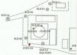
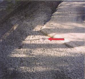
Record of surveying Points
|
Station name |
Tateyama station |
Type of marker |
Intersection of axes |
||||||||||||||
|
Name |
SLR telescope reference point |
Type of Target |
Rotary sheet-type |
||||||||||||||
|
Name of point |
SLR―CP0 |
Size of Target |
50mm |
||||||||||||||
|
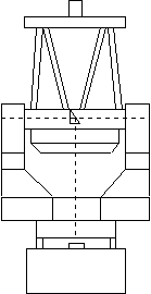
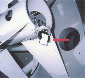
Azimuth axis Tertiary mirror Elevation axis The
reference point (Rotary
target ) Measured point |
|||||||||||||||||
|
Rough sketch of the area near the point
|
Photo of the point
|
||||||||||||||||
|
Remarks The SLR telescope reference point(intersection of Az-El drive axes)on its tertiary mirror was calculated by least square method using target’s nine positions, that were measured whenever SLR telescope was rotated 3 directions around azimuth axis and 3 directions around elevation axis. |
|||||||||||||||||








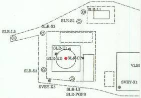
Record of surveying Points
|
Station name |
Tateyama station |
Type of marker |
Reflective mirror |
||||||||||||||||||
|
Name |
SLR external geodetic survey reference point
(long pillar) |
Type of Target |
Rotary sheet-type |
||||||||||||||||||
|
Name of point |
SLR―L1 |
Size of Target |
50mm |
||||||||||||||||||
|
Measured height for target height Measured
height for instrument height Reference
point of long pillar(CCR) Surveying
point(RT) Target height Instrument height Sokkia NET2B 0.120m |
|||||||||||||||||||||
|
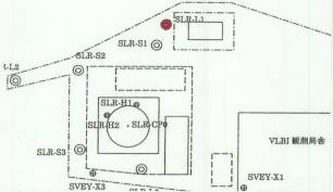
Rough sketch of the area near the point
|
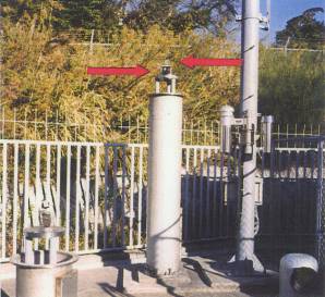
Photo of the point
|
||||||||||||||||||||
|
Remarks The target height was set to zero and the instrument height was measured and calculated. Instrument height=Measured instrument height - Measured target height |
|||||||||||||||||||||




















Record of surveying Points
|
Station name |
Tateyama station |
Type of marker |
Reflective mirror |
||||||||||||||||||
|
Name |
SLR external geodetic survey reference point (long
pillar) |
Type of Target |
Rotary sheet-type |
||||||||||||||||||
|
Name of point |
SLR―L2 |
Size of Target |
50mm |
||||||||||||||||||
|
Reference
point of long pillar(CCR) Surveying
point(RT) Measured height for target height Measured
height for instrument height Target height Instrument height Sokkia NET2B 0.120m |
|||||||||||||||||||||
|
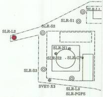
Rough sketch of the area near the point
|
Photo of the point
|
||||||||||||||||||||
|
Remarks The target height was set to zero and the instrument height was measured and calculated. Instrument height=Measured instrument height - Measured target height |
|||||||||||||||||||||




















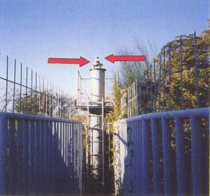
Record of surveying Points
|
Station name |
Tateyama station |
Type of marker |
Reflective mirror |
||||||||||||
|
Name |
SLR external geodetic survey reference point
(long pillar) |
Type of Target |
Rotary sheet-type |
||||||||||||
|
Name of point |
SLR―L3 |
Size of Target |
50mm |
||||||||||||
|
Reference
point of long pillar(CCR) Surveying
point(RT) Plate for GPS antenna Target height 0.120m |
|||||||||||||||
|
Rough sketch of the area near the point
|
Photo of the point
|
||||||||||||||
|
Remarks The target height was set to zero. |
|||||||||||||||








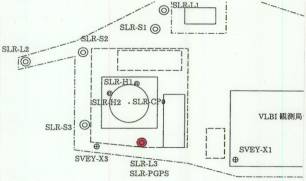
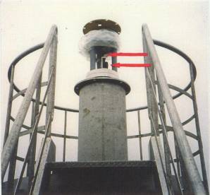
Record of surveying Points
|
Station name |
Tateyama station |
Type of marker |
Reflective mirror |
||||||||||||||||||||||||||||
|
Name |
SLR external geodetic survey reference point
(short pillar) |
Type of Target |
Rotary sheet-type |
||||||||||||||||||||||||||||
|
Name of point |
SLR-S1 |
Size of Target |
50mm |
||||||||||||||||||||||||||||
|
Measured height for target height Surveying
point(RT) Measured height for instrument height Bench mark Bench mark Target height Reference
point of short pillar(CCR) Instrument height Half target 0.120m Half target
Sokkia NET2B |
|||||||||||||||||||||||||||||||
Rough sketch of the area near the point
|
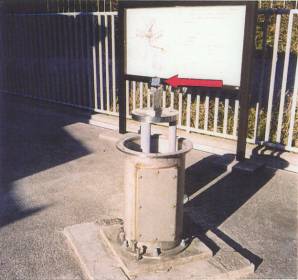
Photo of the point in concern
|
||||||||||||||||||||||||||||||
|
Remarks The target height was set to zero and the instrument height was measured and calculated. Instrument height=Measured instrument height - Measured target height The bench mark of short pillar was measured by using the lower part of the half target. |
|||||||||||||||||||||||||||||||


















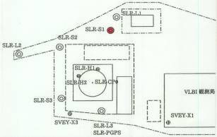
Record of surveying Points
|
Station name |
Tateyama station |
Type of marker |
Reflective mirror |
||||||||||||||||||||||||||||
|
Name |
SLR external geodetic survey reference point
(short pillar) |
Type of Target |
Rotary sheet-type |
||||||||||||||||||||||||||||
|
Name of point |
SLR-S2 |
Size of Target |
50mm |
||||||||||||||||||||||||||||
|
Reference
point of short pillar(CCR) Measured
height for instrument height Surveying
point(RT) Measured height for target height Bench mark Bench mark Target height Instrument height Half target 0.120m Half target
Sokkia NET2B |
|||||||||||||||||||||||||||||||
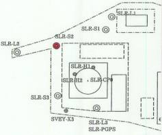
Rough sketch of the area near the point
|
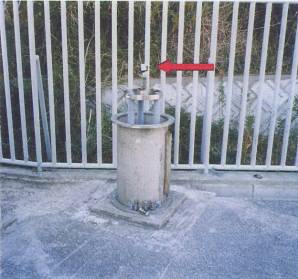
Photo of the point
|
||||||||||||||||||||||||||||||
|
Remarks The target height was set to zero and the instrument height was measured and calculated. Instrument height=Measured instrument height - Measured target height The bench mark of short pillar was measured by using the lower part of the half target. |
|||||||||||||||||||||||||||||||


















Record of surveying Points
|
Station name |
Tateyama station |
Type of marker |
Reflective mirror |
||||||||||||||||||||||||||||
|
Name |
SLR external geodetic survey reference point
(short pillar) |
Type of Target |
Rotary sheet-type |
||||||||||||||||||||||||||||
|
Name of point |
SLR-S3 |
Size of Target |
50mm |
||||||||||||||||||||||||||||
|
Measured
height for instrument height Reference
point of short pillar(CCR) Surveying
point(RT) Measured height for target height Bench mark Bench mark Target height Instrument height Half target 0.120m Half target
Sokkia NET2B |
|||||||||||||||||||||||||||||||
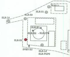
Rough sketch of the area near the point
|
Photo of the point
|
||||||||||||||||||||||||||||||
|
Remarks The target height was set to zero and the instrument height was measured and calculated. Instrument height=Measured instrument height - Measured target height The bench mark of short pillar was measured by using the lower part of the half target. |
|||||||||||||||||||||||||||||||


















Record of surveying Points
|
Station name |
Tateyama station |
Type of marker |
Intersection of axes |
||||||||
|
Name |
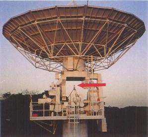
VLBI antenna reference point |
Type of Target |
RT1A |
||||||||
|
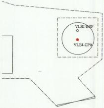
Name of point |
VLBI-CP0 |
Size of Target |
90mm |
||||||||
|
Point of
intersection of elevation axis and azimuth axis Elevation axis(confirmed with fishing
line) Azimuth axis (with mark) |
|||||||||||
|
Rough sketch of the area near the point
|
Photo of the point
|
||||||||||
|
Remarks The target height was adjusted to the
fishing line that was stretched through
the hole of elevation axis. Tribranch was
shifted parallel to the fishing line and the center was adjusted to the mark
of the azimuth axis. |
|||||||||||
























Record of surveying Points
|
Station name |
Tateyama station |
Type of marker |
Reflective target |
||||
|
Name |
VLBI ground marker |
Type of Target |
Rotary sheet-type |
||||
|
Name of point |
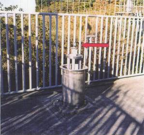
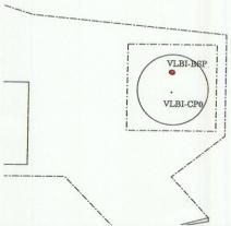
VLBI-BSP |
Size of Target |
50mm |
||||
|
Surveying
point(RT) |
|||||||
|
Rough sketch of the area near the point
|
Photo of the point
|
||||||
|
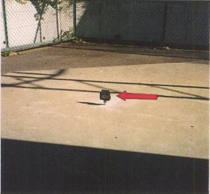
Remarks The target height of VLBI ground marker was set to zero. |
|||||||





Record of surveying Points
|
Station name |
Tateyama station |
Type of marker |
Metallic marker |
||||||||||||||
|
Name |
Ground marker |
Type of Target |
RT1A |
||||||||||||||
|
Name of point |
SVEY―X1 |
Size of Target |
90mm |
||||||||||||||
|
Central
part of metallic marker Central
part of metallic marker RT1A Sokkia NET2B Target height Instrument height |
|||||||||||||||||
|
Rough sketch of the area near the point
|
Photo of the point
|
||||||||||||||||
|
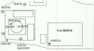
Remarks Ground marker is a sub reference point that is needed for local survey network. |
|||||||||||||||||
























Record of surveying Points
|
Station name |
Tateyama station |
Type of marker |
Metallic marker |
||||||||||||||
|
Name |
Ground marker |
Type of Target |
RT1A |
||||||||||||||
|
Name of point |
SVEY―X3 |
Size of Target |
90mm |
||||||||||||||
|
Central
part of metallic marker Central
part of metallic marker RT1A Sokkia NET2B Target height Instrument
height |
|||||||||||||||||
|
Rough sketch of the area near the point
|
Photo of the point
|
||||||||||||||||
|
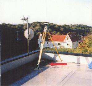
Remarks Ground marker is a sub reference point that is needed for local survey network. |
|||||||||||||||||