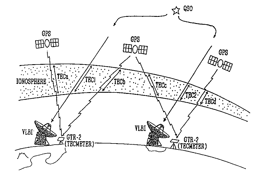
In VLBI geodetic measurements excess delays caused by the charged particles existing along the ray paths from a radio star to each antenna, mainly due to the difference in the terrestrial ionospheric total electron content (TEC) along each ray path, are corrected by receiving dual S(2GHz) and X(8GHz) frequency bands. This dual band receiving system, however, makes it difficult to employ a small antenna (less than 3 m in diameter) for a VLBI remote station in spite of the merits of small antennas such as low cost of construction and ease of transportation. On the other hand the GPS signal measurement provides an independent measurement of the TEC applicable for calibration of the excess delays in case of VLBI measurements made at a single frequency band. Consequently the antenna size can be diminished. The directions of GPS satellites from a station are, however, usually different from those of radio stars observed by VLBI. Hence the TEC obtained by GPS measurements have to be mapped to any other directions. S ome models have been proposed as mapping methods on the basis of assumption of the spherical-shell-like and static ionosphere. Simultaneous observations of dual-band VLBI and of GPS enable us to evaluate models, i.e., we can assess validity of each mapping model through a direct comparison of TECs (or excess delay time at same frequency) obtained by both observations. We have already made this kind of observations several times. According to a preliminary result, some mapping model shows coincidence between VLBI and GPS measurements less than 0.18 nsec at 8 GHz. Now mapping method is being refined to accomplish much better coincidence ($<$0.1 nsec : requirement from a geodetic VLBI).