Wireless Communication Technologies Related with Advanced Air Mobility
& the ‘Drone Mapper®’; for collision avoidance via position awareness
 HOME
>
Virtual Exhibition Room
>
Wireless Communication Technologies Related with Advanced Air Mobility
HOME
>
Virtual Exhibition Room
>
Wireless Communication Technologies Related with Advanced Air Mobility
 Print
Print
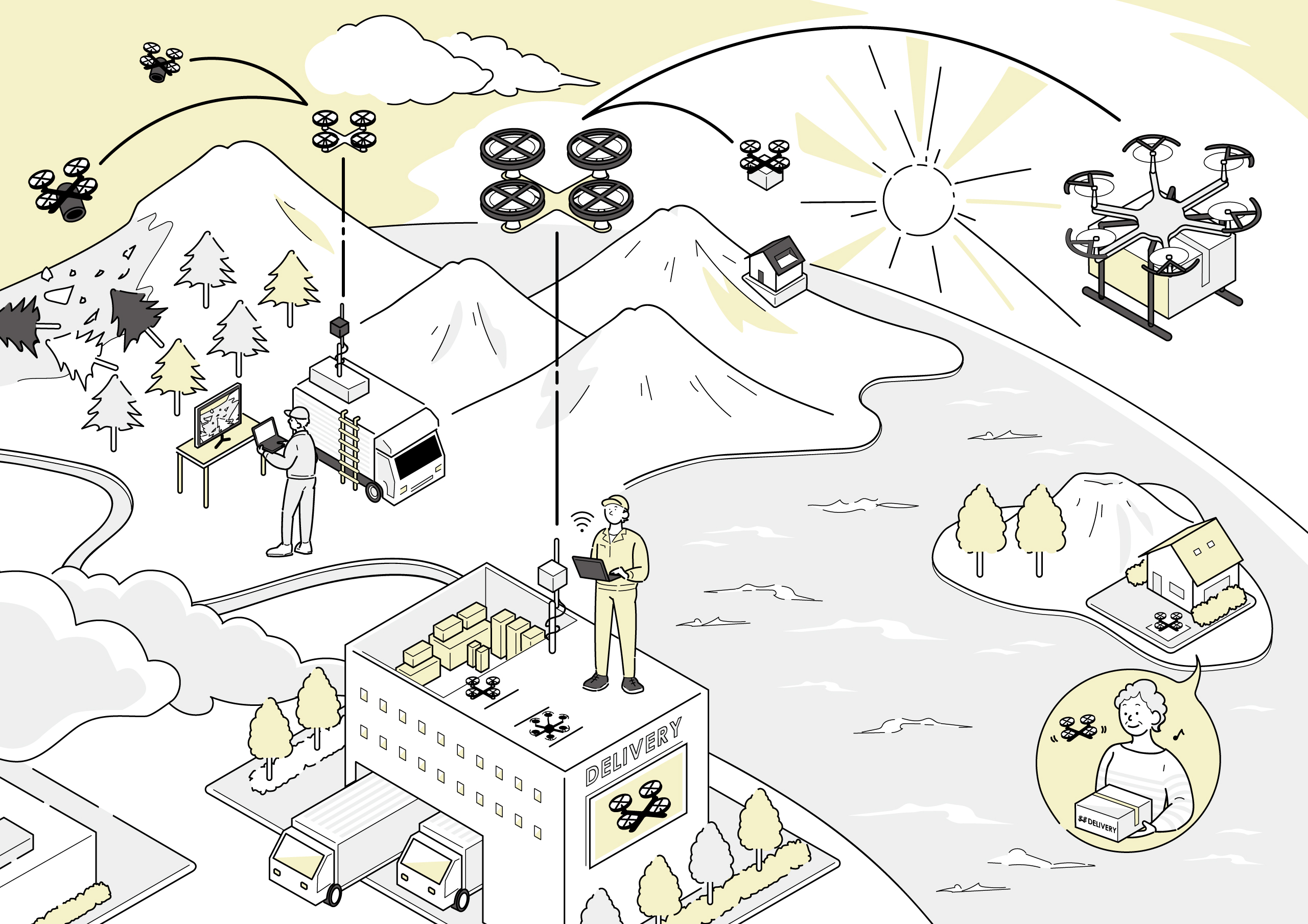
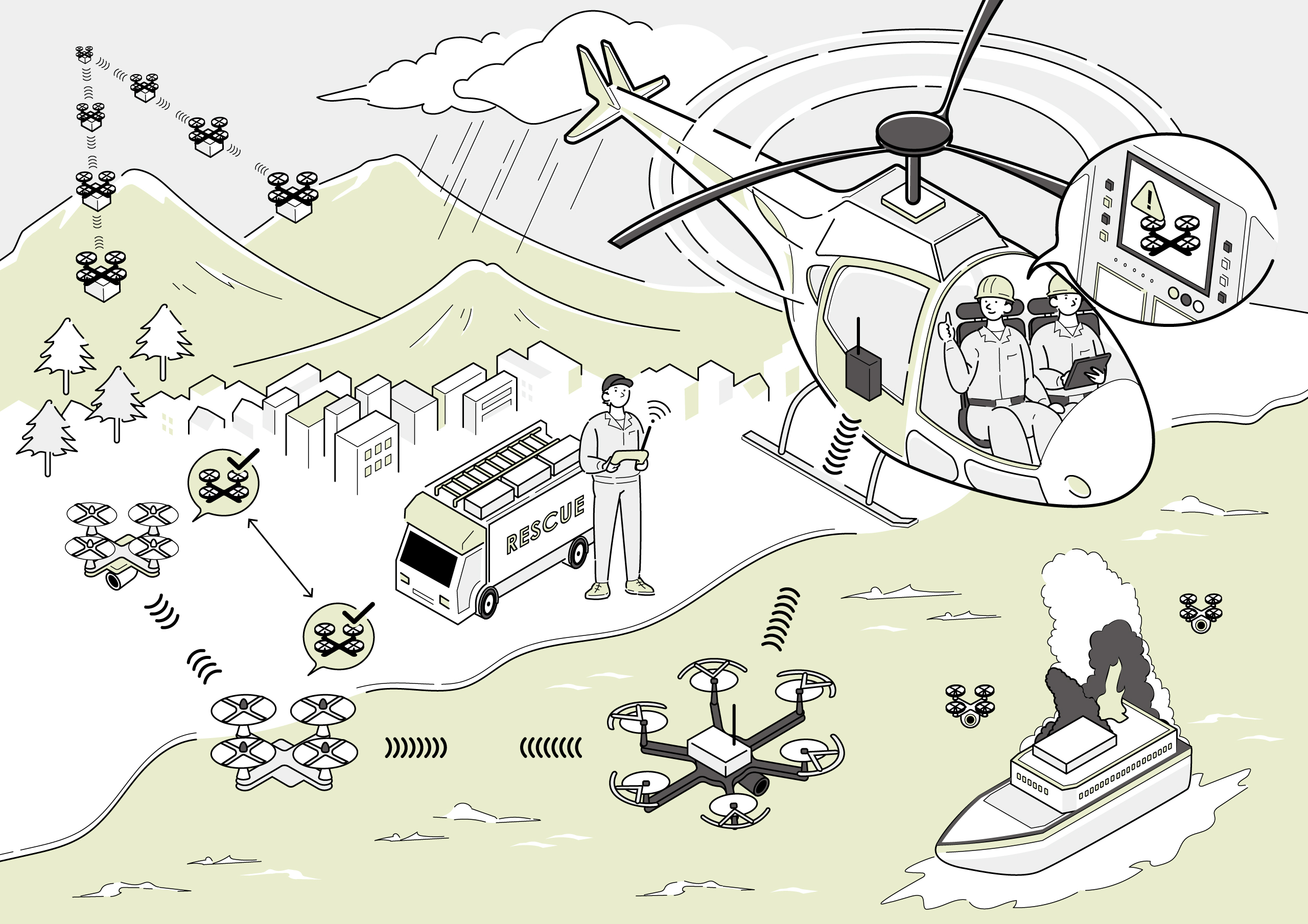
It is expected that air mobilities, such as drones, will be used more and more for aerial photography and cargo delivery in disaster sites where it is difficult for people to go.
There is concern that collisions and other accidents will increase with the increasing number of air mobilities. Wireless technology is therefore vital in safely and reliably operating and controlling such air mobilities.
The ‘Command Hopper’ technology developed by NICT enables low-latency control of drones and air mobilities inflight by flying other drones equipped with repeaters between them like a bucket relay, even when they are hidden by mountains or buildings and radio waves cannot reach them directly from the control side.
NICT has also developed the ‘Drone Mapper®’ system that enables multiple drones to fly without collisions via radio waves determining position and altitude. These technologies and systems are expected to be used not only in times of disaster, but also in forestry, agriculture, wildlife monitoring, and other fields. Verification tests are being conducted in various locations throughout Japan.
Communication Technologies Related to Unmanned Aerial Vehicles (Technical Explanation)
Drone hearing and vision, remote sound source identification drone using onward communication technology.

 wl-publicity@ml.nict.go.jp


Visit us

Need documents

Use the technology

Collaborate with us

Contact Us
If there is any inquiry, please contact us by using our inquiry form.