

 View on Twitter

Access
Wireless Networks
Research Center
(Yokosuka, Kanagawa)
Air Mobility Wireless Communications
 HOME
>
Research Projects
>
Air Mobility Wireless Communications
Command Hopper
The drone research team is researching wireless systems specialized in communications with robots and drones that are active in disaster sites and in the mountains.
It is important for communication with the robot to be "not cut off as much as possible" and "to keep the transmission delay time (the time from when a person sends a command until the robot receives the command) within a certain value". We are researching and developing systems that communicate with a completely different mechanism from the communication methods such as Wi-Fi and Bluetooth used to connect PC peripheral devices.

Technical Description
Command Hopper
When controlling and monitoring robots and drones, 2.4GHz band wireless system is often adopted because of cost and device availability. However, there are many issues when using 2.4GHz wireless for remote control of robots and drones due to problems of radio range and interference.
In this research, we combine two frequencies, the 920 MHz band and the 169 MHz band, and adopt time division multiplexing and multi-hop technology for the communication system. This system has a trade-off relationship between transmission delay time and communication speed, and can be customized according to the requirements of the robot mission.
In recent experiments, communication ranges of over 18 km in line-of-sight conditions and over 5 km in environments with minor obstacles such as mountains and ridges along the path have been confirmed. Additionally, we have successfully controlled a drone and conducted flight operations at a location approximately 25 km away from the ground station, crossing mountains along the way via a relay station placed on a mountaintop.
Glossary
920MHz band
This is a specified low power radio frequency band for telemeters, tele-controls, and data transmission, and it can be used without a license if the radio facility has obtained the technical standard conformity certification by TELEC.
169MHz band
One of the "unmanned mobile image transmission systems" allocated by the Ministry of Internal Affairs and Communications in 2016. It has a wider signal range than the 2.4 GHz and 920 MHz bands, and is characterized by its ability to bypass minor obstacles and reach its destination more easily.
Members
- MATSUMURA Takeshi
- MATSUDA Takashi
- MIURA Ryu
- MARUYAMA Masaaki
- Koshikawa Miho
Publications
NICT Press Releases: We succeeded Japan's first drone control using high reachability new frequency.
Standardization Activities
- Radio equipment for 920MHz band telemeter, tele-control and data transmission
- ARIB STD-T108
News & Information
・Presentation at the 2026 IEICE General Conference: “山岳地の無人航空機による物流のための169MHz帯自営網マルチホップ通信試験” (March 2026)
・Presentation at the 2025 IEICE Society Conference: “小山の回折を含む長距離見通し外での169MHz 帯マルチホップC2 リンクによるUAV 飛行実験” (September 2025)
・Contribution to the IEICE Communications Society Magazine B-Plus: “複数のドローンや無線機の連携による空の安全運航支援のための無線通信” (2025, No. 73, Summer Issue)
Drone Mapper ®
In this study, in order to realize safe operation in an environment where multiple flying objects including drones (small unmanned aerial vehicles) exist, we are conducting research and development on flying object information sharing system called "Drone Mapper ®", which can share the position, altitude and identification information of each flying object obtained via wireless technologies like GPS, through direct communication among drones. By using the "Drone Mapper ®" system, the flying objects can automatically perform flight control so that they can automatically avoid approaching each other or follow other flying objects without the manual control of the pilot.
Technical Description
Drone Mapper ®
The location information sharing system called "Drone Mapper ®" is a communication system between aircrafts using the 920MHz wireless band.
We are conducting experiments with the aim for applying our system in future drone operation management systems, using the 920 MHz band (LPWA standard, 20 mW transmit power), which does not require a license, if there is no obstacle object, we have confirmed that it is possible to grasp the mutual flight position and identification number of each aircraft every second over a distance of about 9km.
Glossary
920MHz band
This is a specified low power radio frequency band for telemeters, tele-controls, and data transmission, and it can be used without a license if the radio facility has obtained the technical standard conformity certification by TELEC.
The device we developed allows users to switch between the LPWA (Low-Power Wide-Area) standard, which supports long-range communication, and the FSK (Frequency Shift Keying) standard, which supports communication up to about 1 km and provides a large number of channels.
GNSS
A satellite-based positioning system that uses signals transmitted from artificial satellites to determine position, provide navigation, and distribute time.
Members
- MATSUMURA Takeshi
- MATSUDA Takashi
- MIURA Ryu
- MARUYAMA Masaaki
- Koshikawa Miho
Publications
NICT Press Releases: Automatic near-miss avoidance for drones using V2V direct communications
Gallery
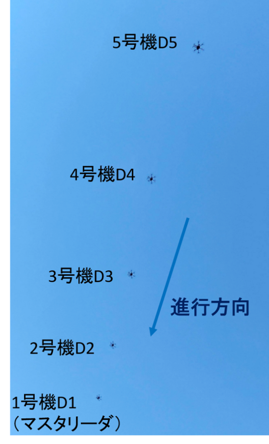
(a) Avoidance between aircraft of the same priority (such as unmanned aircraft) approaching head-on
Figure 2: Video of flight trajectories demonstrating autonomous collision avoidance via inter-aircraft communication using the Drone Mapper
CONTACT
If you have any questions for the Wireless Systems Lab., please contact us by using our inquiry form.

 Twitter
Copyright © Wireless Networks Research Center. All Rights Reserved.