Impulse-Radio Ultra-WideBand (IR-UWB)
 HOME
>
Virtual Exhibition Room
>
Impulse-Radio Ultra-WideBand (IR-UWB)
HOME
>
Virtual Exhibition Room
>
Impulse-Radio Ultra-WideBand (IR-UWB)
 Print
Print
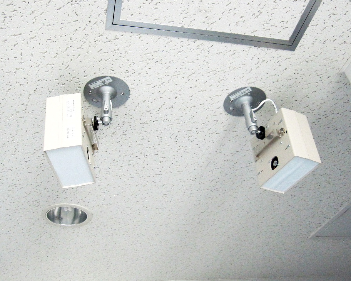
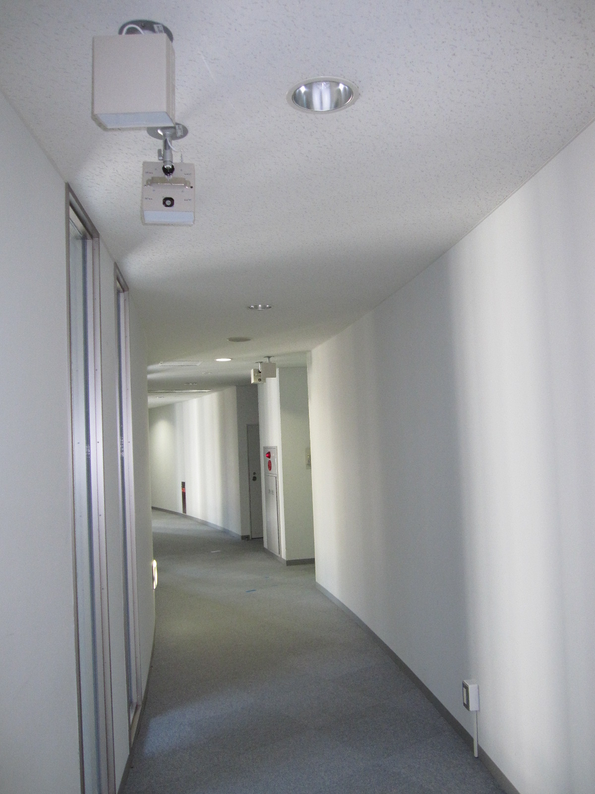
IR-UWB stands for ‘Impulse Radio Ultra Wideband’; a radio wave with a very short time pulse; a nano second (10-9).
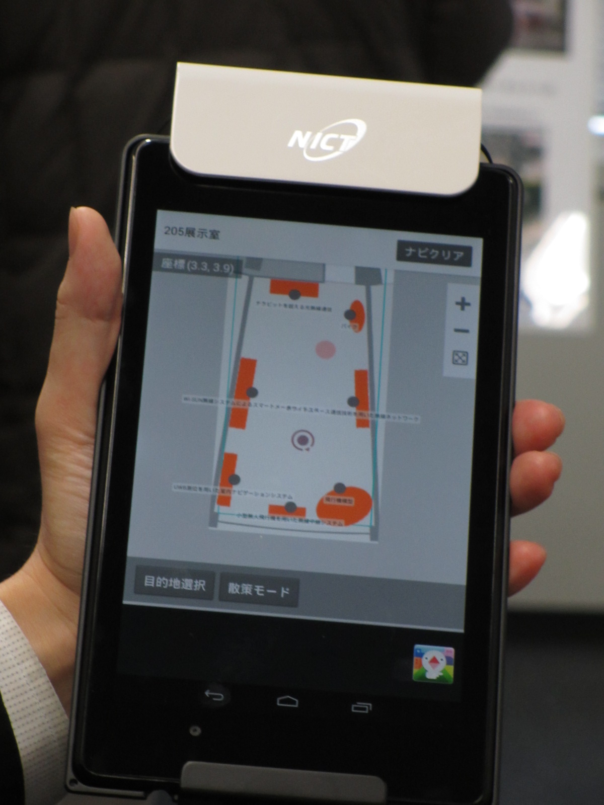
Map applications; such as Google Maps, and car navigation systems use location information sent from space positioning satellites called GPS*1. Such satellite signals cannot reach inside buildings or underground however, so indoor positioning systems are needed.
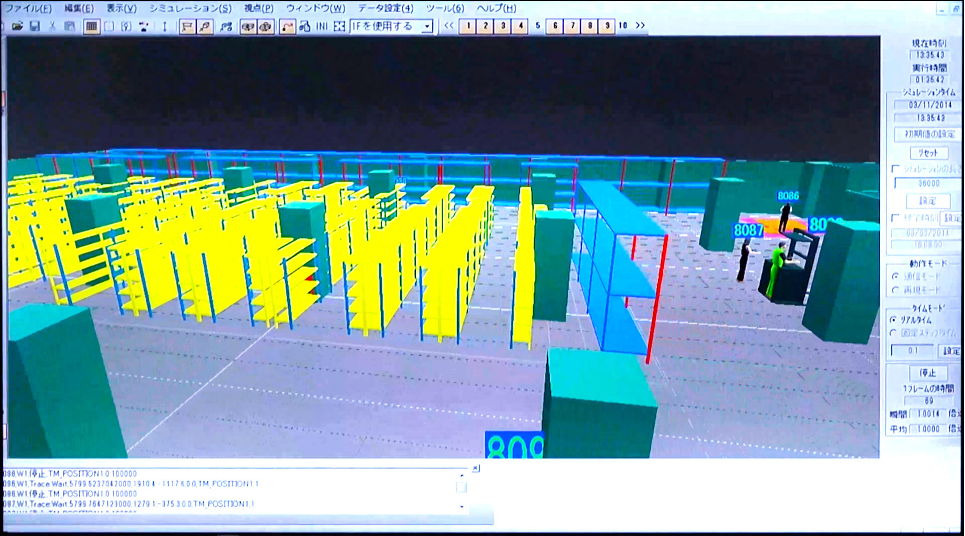
NICT has developed an indoor positioning system using IR-UWB that can measure locations with an accuracy of several tens of centimeters, an order of magnitude higher than Wi-Fi (several meters) and IMES (ten meters).
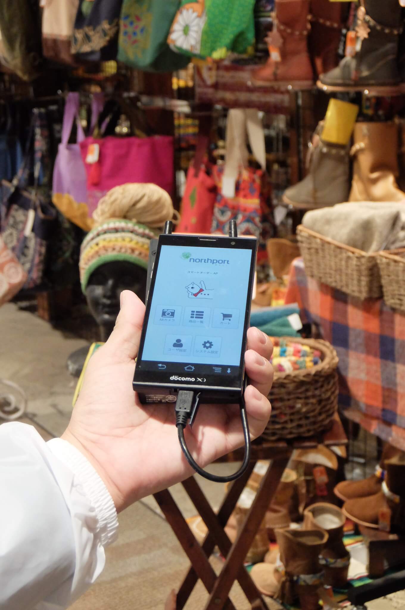
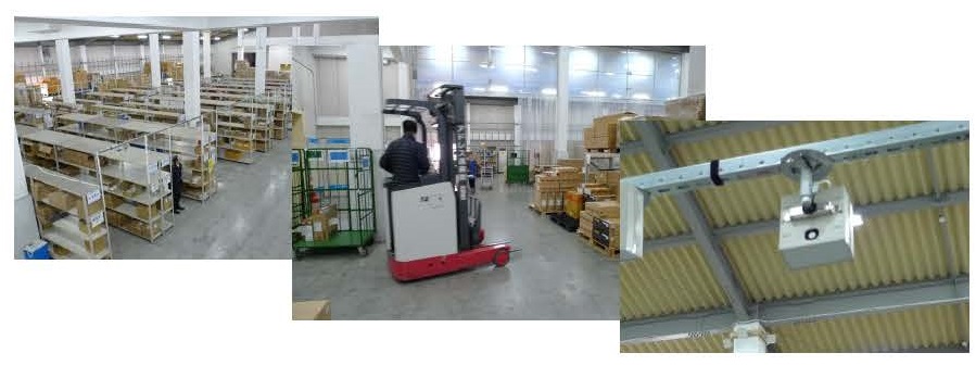
Through experiments in shopping malls and logistics warehouses, we have demonstrated that the system is useful for in-store navigation and location-based coupon distribution, as well as for improving operational efficiency, such as improving the positioning and flow lines of workers, forklifts, and other equipment in warehouses.
*1 GPS: Global Positioning System

Development and Applications of a UWB Indoor Positioning System (NICT NEWS Aug 2014, No.443)


 wl-publicity@ml.nict.go.jp

Visit us

Need documents

Use the technology

Collaborate with us

Contact Us
If there is any inquiry, please contact us by using our inquiry form.